Bands of rain have been passing over the area off and on all day as Ida moved closer to the Northwest Florida coast. The wind is starting to gust now. Tim put up the small yard waste cans; the large garbage cans ought to be all right. The regular trash has some big bags of cat litter in it which should help hold it down. In addition, we piled in some small limbs that had been sitting in the back yard for a while. Our workplaces both shut down early today, which gave us a chance to get those last minute preps done while we still had daylight.
I'm charging my cell phone, and I really ought not to be running the laptop off battery, but it's easier, and I don't expect to lose power. I'll plug it in later to top off the charge, then unplug it when things get bad to protect against surges.
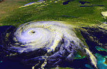
Today, the National Hurricane Center has taken the line off the graphic showing the projected path. Perhaps too many people are focusing on that line and not on the fact that this is a large storm with tropical storm force winds extending 200 miles from the center. That means, the storm is 400 miles across, and even if you're on the very edge of the storm, you will experience sustained winds of 38mph or more.
Ida will not, for most people, be catastrophic, however, hurricanes and tropical storms can spin off tornados. Sustained high winds over several hours can break a weak limb, pull up a loose shingle, and cause other damage. Nothing to worry about unless it's your house that suddenly springs a leak or your car that has a broken windshield from a broken branch.
Now, while tropical storms and National Hurricane Advisories are on everyone's mind, the NHC is looking for input about how their public advisories are presented. Take a moment and go to the NHC's discussion page. They present several examples of public advisories prepared in the current style and the proposed new style. Compare them, then drop the NHC a note letting them know what you like and don't like. This will determine how information is presented in the future.
Subscribe to:
Post Comments (Atom)
No comments:
Post a Comment