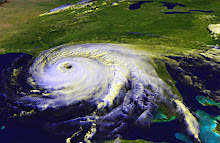
In recent years, we've seen several storms coming up through the Gulf of Mexico that were not forecast to become major hurricanes until just hours before landfall.

Scientists are now studying what causes this rapid intensification. One theory is that when we have a busy hurricane season, one storm comes through and churns up the Gulf waters. The cooler waters are pulled to the surface, and the warm water is pushed down. After the storm, the surface waters warm up, but the deeper water doesn't have time to cool down before the next storm comes through.
Warm water fuels hurricanes.
A group called Saildrone is sending their autonomous boats into hurricanes in 2021 to collect data at surface level.
Hopefully, we will learn more about this phenomenon of rapid intensification, so forecasters can more accurately predict the strength of a storm early on, giving coastal residents more time to prepare.
It's best to always assume the worst is going to happen. If you put your shutters up expecting a Cat4 or 5 storm, and it turns out it's only a tropical storm, it's just a few hours wasted. If you expect a tropical storm or a Category 1, and you don't prepare, you could be putting your safety at risk.
My Mam-ma always said, "Better safe than sorry."