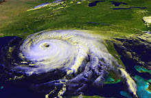
I looked at the National Hurricane Center website last night before going to bed, and we had three low pressure systems. The forecasters said one of those was likely to develop into a named storm.
Tonight, I finally get a chance to sign on, and now we have two named storms, Ana and Bill. Long term forecasts show Ana coming into the Gulf and heading right this way, with Bill veering north up the east coast.
Of course, these forecasts are just educated guesses. That's why they give us the cone of uncertainty, because a slight wobble today could mean several hundred miles difference in where the storm ends up a week from now.
I'm not a trained meteorologist or hurricane forecaster. I'm just a very interested amateur. As I'm analyzing the storm and its path, I like to go to the National Weather Service website and look at the 6-day outlook maps. Scroll down, and you'll see eight little maps that you can click on for a bigger image. The maps show how high fronts and low fronts are expected to form and move over the next week.
How this helps in tropical cyclone forecasting is that the cyclone aka tropical storm aka hurricane is a low pressure system, and lows are attracted to lows. A high pressure system, on the other hand, will push the tropical system away.
If you look at the map for six days out, you'll see a high pressure system that extends into Northwest Florida. That's good for me, here in Pensacola. That means Ana probably won't hit here, though we will probably feel some effects, such as rain bands, some wind, higher tides and possibly some flooding around the coast or rivers.
Now, I must point out that those highs and lows may not develop or move in the way the National Weather Service thinks they will. If that high doesn't sweep down into NW Florida at exactly the right time, the storm could come right this way. Plus, the highs and lows aren't the only things that affect tropical cyclones. Other atmospheric steering currents will affect movement, and water temperature affects intensity.
You can see Ana and Bill on the NWS outlook maps. They've got Ana moving across the southern tip of Florida (kind of like Andrew did in 1992), and that's why it shows as a Tropical Storm on the 5-day outlook and a Low on the 6-day. Crossing land weakens the storm.
The National Hurricane Center and Accuweather show Ana passing south of Florida and remaining a Tropical Storm as it enters the Gulf. That means it would remain at T.S. strength and possibly get even stronger, fueled by the Gulf's warmer waters.
Now, let's talk about Bill. Bill is expected to be a full-fledged hurricane by Monday. Most of the computer models show this storm curving to the north with a path that could affect Bermuda and/or New England and/or Canada's east coast. At this point, one model shows the storm making a sharp turn west and hitting the Carolinas. Sometimes a path that's really drastically different from all the other models means that the particular model either didn't account for something that all the others did or there's a error in the calculation somewhere. Or maybe that's the one model that got it right. Landfall is several days away and a lot of different factors will play into which way this storm goes.
If you live along the Gulf Coast or the Atlantic Coast, for the next week or so it's going to be important to pay attention to what's happening, take some preliminary steps to prepare, and be ready to do what it takes to protect your family and property.
Subscribe to:
Post Comments (Atom)
No comments:
Post a Comment