If I lived on the island of Bermuda or in a coastal community on the Eastern Seaboard, I would buy some extra water and canned goods, make sure I had fresh batteries for the radio and flashlights, and keep a close eye on Hurricane Danielle.
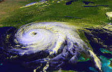
Danielle is currently a category 2 hurricane and is expected to strengthen over the next couple of days.
The National Hurricane Center shows Danielle continuing to travel north in the Atlantic, with the eye passing to the east of Bermuda, but several computer models show the storm making a sharp turn to the west, which could take it into one of the mid-Atlantic states. And even if the storm's eye misses Bermuda, the island is still likely to get some high winds, heavy surf and flooding.
The effects of a hurricane can reach hundreds of miles from the eye. When Hurricanes Gustav and Ike crossed the Gulf in 2008, they were hundreds of miles from Northwest Florida's Gulf Coast, but low-lying areas and waterfront properties still experienced storm surge-related flooding.
What's the harm of stocking up on a few supplies now? You can still drink the water and eat the food, even if the storm doesn't hit and you don't lose power. You'll still use the batteries in your cameras, toys, or remote controls. If the storm does come your way, you'll be glad you hit the grocery store before the frenzy started, plus you'll gain time to do all the other prep needed before a hurricane strike.
While you're keeping an eye on Danielle, watch Tropical Storm Earl as well. The computer models are showing Earl following a similar track to Danielle, although none of them are showing Earl turning to the west. At least not yet.
I won't rest easy until it actually makes the northerly turn that everyone's predicting. Right now, it's aimed squarely towards the Gulf.
Subscribe to:
Post Comments (Atom)
No comments:
Post a Comment