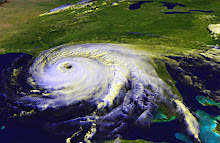
Tropical Storm Emily started as a tropical wave in the southern Atlantic a few days ago. The National Hurricane Center is now tracking Emily, which is expected to hit several Caribbean islands before brushing against the east coast of Florida next weekend.
Of course, it's dangerous to look at the track now and assume that's where the storm is going.
The computer models have been steadily shifting west for the past few days, and if it shifts much more to the west, it'll come into the Gulf.
Looking at the national maps from the National Weather Service, an area of high pressure seems to be forming or moving across the Gulf and parts of the northern Gulf Coast. That could be what hurricane forecasters are looking at to keep the storm moving north in the Atlantic. Certainly if it shifts west and comes into the Gulf, that High could keep it to the eastern part of the Gulf.
If you live on a southeastern U.S. coastline, this storm bears watching.
Monday, August 1, 2011
Subscribe to:
Post Comments (Atom)

No comments:
Post a Comment