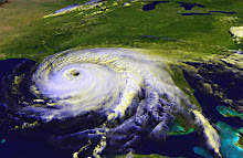
Unless something incredible happens and Jimena loses a lot of steam very quickly, Mexico's Baja Peninsula is going to be slammed in the next few hours by a Category Four storm. With maximum sustained winds of 155mph as I write this, if Jimena gains even a little strength, it will become a Cat 5. This storm is going to be catastrophic. I have to admit, my focus has been on the Atlantic, because it's more likely to affect my area. In the meantime, this massive storm has formed in the Pacific and made a beeline for land.
Because the peninsula is just a narrow strip of land, and because the storm is going to be so strong, I think I would evacuate if I lived there. Of course, I don't know the terrain. Maybe there's some higher ground that will be safe from storm surge, if the structure is sturdy enough to withstand a constant battering from extremely high winds over several hours.
Structures built on high land also may be at risk of mudslides washing out the foundation. I've seen that happen in hilly areas of Mexico and the Caribbean Islands when they're hit by a hurricane.
Bottom line, if you're reading this and you're in Baja California, please be safe. Make informed decisions based on official sources, such as the National Hurricane Center and your local government. Consider what the intense winds, storm surge, and heavy rains could do to your home and your neighborhood, and be safe.
Please take pets with you.
If you are staying, be sure you have enough food and water for your family and pets for at least three days. Barricade the windows with wood or metal sheets to keep flying debris and pounding winds from breaking the glass. Check supplies of flashlights, batteries, portable radios. Be sure you have enough prescription medication, if you take any. If there's any chance of flooding, have sandbags ready to keep water out of your home.
Put valuables in plastic storage tubs or plastic bags. That way if water does get in, over the doorjam or through a damaged roof or windows, maybe some of your things will be spared. Know where your insurance paperwork is.
If your home sustains damage, remember, you can and should make temporary repairs as you are able -- please be careful -- and document what you did. Your insurance company will want to know that you tried to minimize the damage as much as possible.
God be with you.
Folks on the Atlantic and Gulf Coast should still be keeping an eye on the big red blob now in the Atlantic. The computer models are all over the place, meaning there's no telling where this thing will end up. It's taking a long time to develop into anything, which is good. Maybe it will never get very strong. However, the fact that it is a red blob (as opposed to orange or yellow) means there's a very good chance this system will become a named storm.
The American Red Cross has just debuted a new website with fun ways to learn about and think about preparedness. It's part of a campaign called Do More Than Cross Your Fingers. Visit the site, play the games, and think about your own emergency plan. Are you ready?
Monday, August 31, 2009


Wednesday, August 26, 2009
Now there's T.S. Danny
The red blog last night is Tropical Storm Danny this evening. Though the NHC is calling Danny "poorly organized," forecasters are predicting that the storm will become a Hurricane by Saturday. Expect to feel some outward effects of the storm in North Carolina and states north of there; the cone of uncertainty brushes the edges of several Atlantic-coast states and Washington, D.C. The track keeps the eye of the storm at sea for the next several days. New England and Canada will likely take another hit.
If I lived in those areas, I'd make sure to pick up lightweight lawn furniture, outdoor ornaments, and toys that might get blown around in a strong wind, and I'd keep an eye on the storm's track and intensity in case anything changes.
Meanwhile, there's another tropical wave off the coast of Africa. That one bears watching.
If I lived in those areas, I'd make sure to pick up lightweight lawn furniture, outdoor ornaments, and toys that might get blown around in a strong wind, and I'd keep an eye on the storm's track and intensity in case anything changes.
Meanwhile, there's another tropical wave off the coast of Africa. That one bears watching.
Tuesday, August 25, 2009
Another Storm Brewing in the Atlantic?
The orange blob I blogged about last night is red tonight, meaning the National Hurricane Center thinks that low pressure system is going to develop into a tropical depression soon. The computer models available over at Weather Underground continue to suggest that the system will follow a similar path to Hurricane Bill, up the eastern seaboard between the U.S. and Bermuda. Some of the models have it hitting New England or Canada. Others have it spinning out into the north Atlantic. If you live on the east coast, it's worth checking the NHC website each day to see what effects you might see in your area.
Monday, August 24, 2009
A New Area of Interest
Bill has broken up in the north Atlantic. Now the National Hurricane Center is watching a new area of interest. This morning, the area was yellow, indicating a low chance of development into a tropical depression. This afternoon, the area is orange, indicating a moderate chance of development.
Computer models forecast the low pressure system following a similar path to Bill's. North in the Atlantic, somewhere between the Eastern U.S. and Bermuda.
It may fizzle out or it may strengthen. Keep an eye on it.
Computer models forecast the low pressure system following a similar path to Bill's. North in the Atlantic, somewhere between the Eastern U.S. and Bermuda.
It may fizzle out or it may strengthen. Keep an eye on it.
Sunday, August 23, 2009
A hurricane is not a show.
I was saddened and angered to hear that a seven-year-old girl was swept out to sea by Hurricane Bill. The child was with her family, on a rocky coastal overlook, watching the waves. The parents will have to live with this mistake for the rest of their lives. I guess they thought it would be pretty or interesting for the children to see the force of nature. Perhaps they considered it educational or just a weekend diversion.
Up and down the east coast, you can find reports today of people who drowned or nearly drowned in high waves and rip currents exacerbated by the passing hurricane. Surfers always think they're safe, but the fact is that no one, even the most experienced swimmer, is truly safe when a violent storm passes by. The waves are volatile, the winds gusting and changing, the tides higher than normal.
These deaths were completely preventable. These people could have stayed home, stayed away from the beaches, and watched storm video on The Weather Channel or the internet.
In addition to the lives lost, Coast Guard teams and lifeguards put their own safety at risk to rescue or try to rescue people who willingly put themselves in the danger zone for a pretty view or a bitchin' wave.
No one will learn from these tragedies. The next time a storm passes by, people will flock to the beaches and coastlines to see for themselves the force of nature, to ride the waves in defiance of the storm's wrath. Some of them will never come home.
Up and down the east coast, you can find reports today of people who drowned or nearly drowned in high waves and rip currents exacerbated by the passing hurricane. Surfers always think they're safe, but the fact is that no one, even the most experienced swimmer, is truly safe when a violent storm passes by. The waves are volatile, the winds gusting and changing, the tides higher than normal.
These deaths were completely preventable. These people could have stayed home, stayed away from the beaches, and watched storm video on The Weather Channel or the internet.
In addition to the lives lost, Coast Guard teams and lifeguards put their own safety at risk to rescue or try to rescue people who willingly put themselves in the danger zone for a pretty view or a bitchin' wave.
No one will learn from these tragedies. The next time a storm passes by, people will flock to the beaches and coastlines to see for themselves the force of nature, to ride the waves in defiance of the storm's wrath. Some of them will never come home.
Saturday, August 22, 2009
Bill Heads North
I'm very happy to hear that Bill was not too rough on Bermuda. It looked like it was going to be a very large and dangerous storm, but luck was with the island and the hurricane's intensity diminished, in addition to the track taking it farther west than had been anticipated a few days ago.
Now Bill is heading to New England as a Category 1 storm. It still poses a threat of storm surge and flooding, as well as some wind damage.
It is always better to err on the side of caution, and to stock up on supplies, be prepared with an emergency plan, and take every step to prepare your home and family for the worst. I would rather be ready and not need my supplies, than to not prepare and have the damage be worse than anticipated.
Now Bill is heading to New England as a Category 1 storm. It still poses a threat of storm surge and flooding, as well as some wind damage.
It is always better to err on the side of caution, and to stock up on supplies, be prepared with an emergency plan, and take every step to prepare your home and family for the worst. I would rather be ready and not need my supplies, than to not prepare and have the damage be worse than anticipated.
Thursday, August 20, 2009
Bill's Getting Bigger
According to the latest advisory from the National Hurricane Center, Hurricane Bill is about 510 miles across. Hurricane force winds extend out 105 miles from the eye (that's one way). Tropical storm force winds will be felt up to 260 miles from the center. Sustained winds are currently 125 miles per hour, a strong Category 3 storm. It's good that the winds have fallen down a bit, although the NHC advisory says the storm could pick up strength again on Friday. The U.S. east coast and Bermuda will experience storm surge, and will very likely feel a lot of wind and rain.
The latest track seems to have Bill passing a bit further west of Bermuda than it showed earlier in the week. Of course, there's always a margin of error, hence the "cone of uncertainty" that appears around the forecast track on most maps.
If you're interested in reviewing the accuracy or inaccuracy of the National Hurricane Center's forecasts, here's a great place to go: the Graphics Archive. That link will take you to a list of choices. I like to use the 5-day forecast with cone of uncertainty. When you click on the link, you'll get a slideshow of all the forecast maps since the NHC has been tracking the storm. You can use the controls at left to STOP the automatic loop, then use the little arrow buttons to toggle one frame at a time. This is good because the size of the map changes sometimes, resulting in a kind of jump cut that can be disorienting.
It's very interesting to see how the storm's track changes while still generally staying within the "cone of uncertainty."
Otherwise, the tropics remain calm, after a somewhat surprising burst of activity over the past week.
I wish everyone well who's anywhere near the path of Hurricane Bill.
The latest track seems to have Bill passing a bit further west of Bermuda than it showed earlier in the week. Of course, there's always a margin of error, hence the "cone of uncertainty" that appears around the forecast track on most maps.
If you're interested in reviewing the accuracy or inaccuracy of the National Hurricane Center's forecasts, here's a great place to go: the Graphics Archive. That link will take you to a list of choices. I like to use the 5-day forecast with cone of uncertainty. When you click on the link, you'll get a slideshow of all the forecast maps since the NHC has been tracking the storm. You can use the controls at left to STOP the automatic loop, then use the little arrow buttons to toggle one frame at a time. This is good because the size of the map changes sometimes, resulting in a kind of jump cut that can be disorienting.
It's very interesting to see how the storm's track changes while still generally staying within the "cone of uncertainty."
Otherwise, the tropics remain calm, after a somewhat surprising burst of activity over the past week.
I wish everyone well who's anywhere near the path of Hurricane Bill.
Subscribe to:
Posts (Atom)